Hobbies & Leisure Books

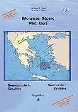
Πλοηγικός χάρτης PC5: Νοτιοανατολικές Κυκλάδες

Author: Nikolaos Ilias

The series of Navigational charts currently consists of the following maps, aimed at covering the Greek territory with 23 maps + 3 general ones:

  • -PC1 Saronic Gulf
  • -PC2 Eastern Peloponnese
  • -PC3...

The series of Navigational charts currently consists of the following maps, aimed at covering the Greek territory with 23 maps + 3 general ones:

  • -PC1 Saronic Gulf
  • -PC2 Eastern Peloponnese
  • -PC3 Northern Cyclades
  • -PC4 Southwestern Cyclades
  • -PC5 Southeastern Cyclades
  • -PC6 Evoikos Gulf
  • -PC7 Corinthian Gulf
  • -PC8 Patraikos Gulf
  • - Kefalonia

They are enriched with...

See full description See full description

Top specs

Genre: Maps
21 25
Delivery Thu, 13 Aug - Mon, 17 Aug
14,00 €   shipping cost
Sent from Greece
From Ebooks 5.0 (26)
Greece
See Books on the page of Ebooks

Learn more about invoicing

Description

Description

The series of Navigational charts currently consists of the following maps, aimed at covering the Greek territory with 23 maps + 3 general ones:

  • -PC1 Saronic Gulf
  • -PC2 Eastern Peloponnese
  • -PC3 Northern Cyclades
  • -PC4 Southwestern Cyclades
  • -PC5 Southeastern Cyclades
  • -PC6 Evoikos Gulf
  • -PC7 Corinthian Gulf
  • -PC8 Patraikos Gulf
  • - Kefalonia

They are enriched with nautical information regarding:

  • - Hazards, shoals, instructions for narrow passages, firing fields, etc.
  • - Currents and their characteristics
  • - Winds, their peculiarities and frequency, etc.
  • - Markers for lights, entrances, shoals, etc.
  • - Waypoints
  • - Official and local names
  • - Protection of anchorages from adverse weather conditions

The back side of the map contains:

  • - The ports and bays of the area
  • - Photos of the ports/bays and recognition points (area configuration, points on the horizon, etc.)
  • - The distances between the ports/bays

They are laminated on both sides to withstand water, tearing, and wear of colors.

Manufacturer

See full description

Specifications

Specifications

Author
Nikolaos Ilias
Publisher
Eagle Ray
Language
Greek
Cover
Soft
Release Date
12/2012
Publication Date
2012
Dimensions
17x25 cm
Award
-
ISBN-13
9789609013185

Important information

Specifications are collected from official manufacturer websites. Please verify the specifications before proceeding with your final purchase. If you notice any problem you can report it here.

See all specifications

Description & Specifications

The series of Navigational charts currently consists of the following maps, aimed at covering the Greek territory with 23 maps + 3 general ones:

  • -PC1 Saronic Gulf
  • -PC2 Eastern Peloponnese
  • -PC3 Northern Cyclades
  • -PC4 Southwestern Cyclades
  • -PC5 Southeastern Cyclades
  • -PC6 Evoikos Gulf
  • -PC7 Corinthian Gulf
  • -PC8 Patraikos Gulf
  • - Kefalonia

They are enriched with nautical information regarding:

  • - Hazards, shoals, instructions for narrow passages, firing fields, etc.
  • - Currents and their characteristics
  • - Winds, their peculiarities and frequency, etc.
  • - Markers for lights, entrances, shoals, etc.
  • - Waypoints
  • - Official and local names
  • - Protection of anchorages from adverse weather conditions

The back side of the map contains:

  • - The ports and bays of the area
  • - Photos of the ports/bays and recognition points (area configuration, points on the horizon, etc.)
  • - The distances between the ports/bays

They are laminated on both sides to withstand water, tearing, and wear of colors.

Manufacturer

Author
Nikolaos Ilias
Publisher
Eagle Ray
Language
Greek
Cover
Soft
Release Date
12/2012
Publication Date
2012
Dimensions
17x25 cm
Award
-
ISBN-13
9789609013185

Important information

Specifications are collected from official manufacturer websites. Please verify the specifications before proceeding with your final purchase. If you notice any problem you can report it here.

21,25 €
14,00 €   shipping cost